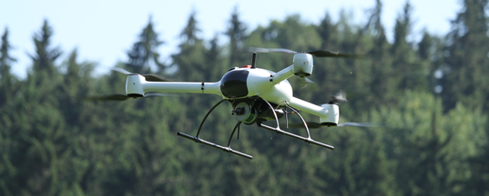
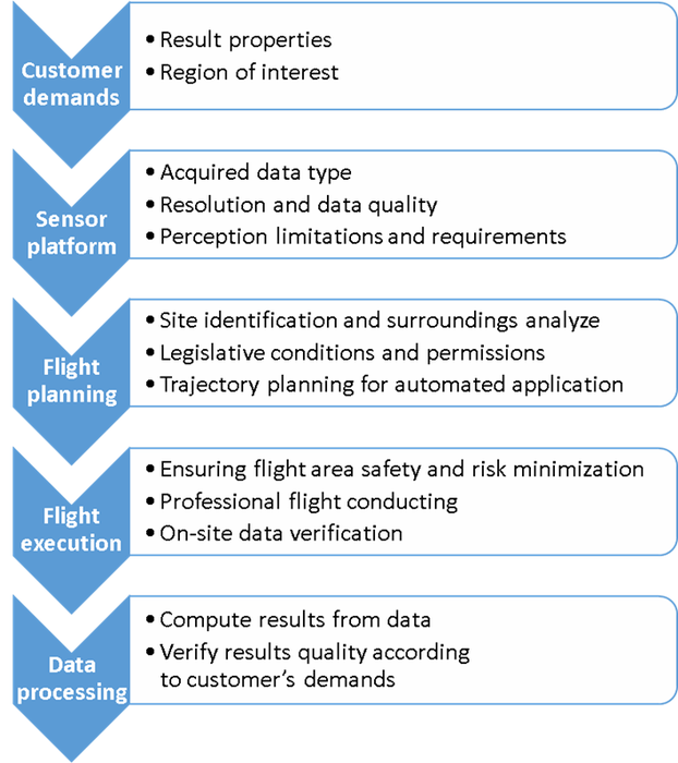
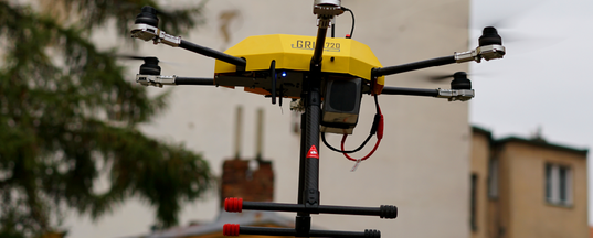
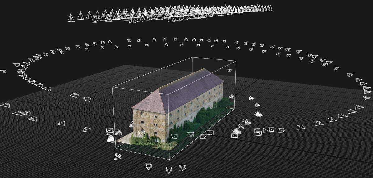
Aerial work is mostly carried out by a human-controlled aircraft nowadays. We focus on higher level of aerial work automation, which outperforms human in terms of speed, precision and repeatability. Our process consists of several phases starting from specification of desired outputs, flight trajectory planning considering terrain, obstacles and sensor parameters, automated flight execution and data acquisition, on-site data verification and automated offline processing.
Services for end-user customers
We have a long term experience with aerial data acquisition, fusion and processing using various sensors. Whatever data you need to acquire, we can help you select appropriate platform and sensors, design and execute data acquisition phase, process data and deliver outputs in short time.
Aerial imaging and the collection of primary data for further processing is a complex task which successful implementation requires extensive experience and skills that our employees have at your disposal. We are able to deliver a complete package of services from the framework of aerial works:
What our customer don't need to think on?
- Purchase and manage your own equipment
- Risks associated with UAV operation
- Training of own staff
- Ensuring legislative requirements for Aerial work
- Ensuring security and accountability
- Effectiveness of the scanning procedures applied
- Risks of repeat scanning due to errors
- Ownership of data processing tools
- Expert knowledge to assess the quality of the results
Mapping and 3D modelling
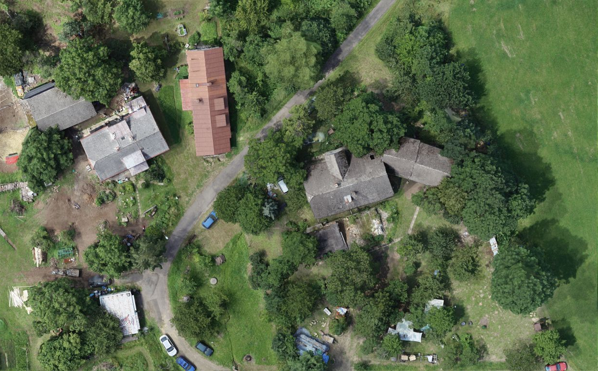
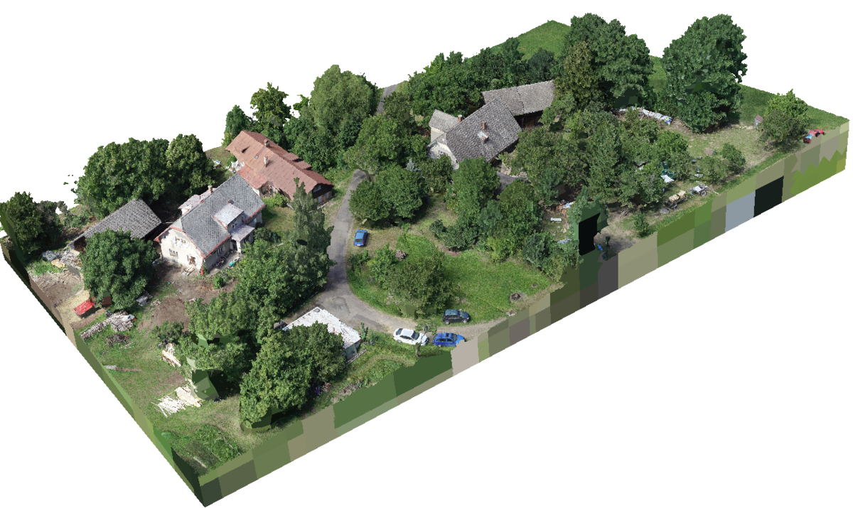
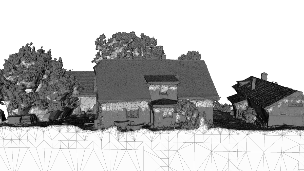
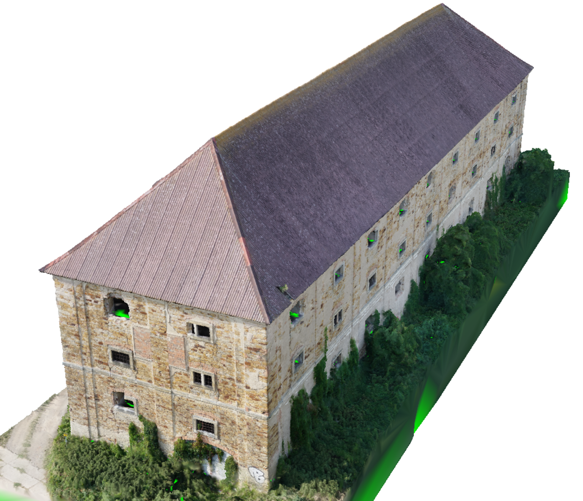
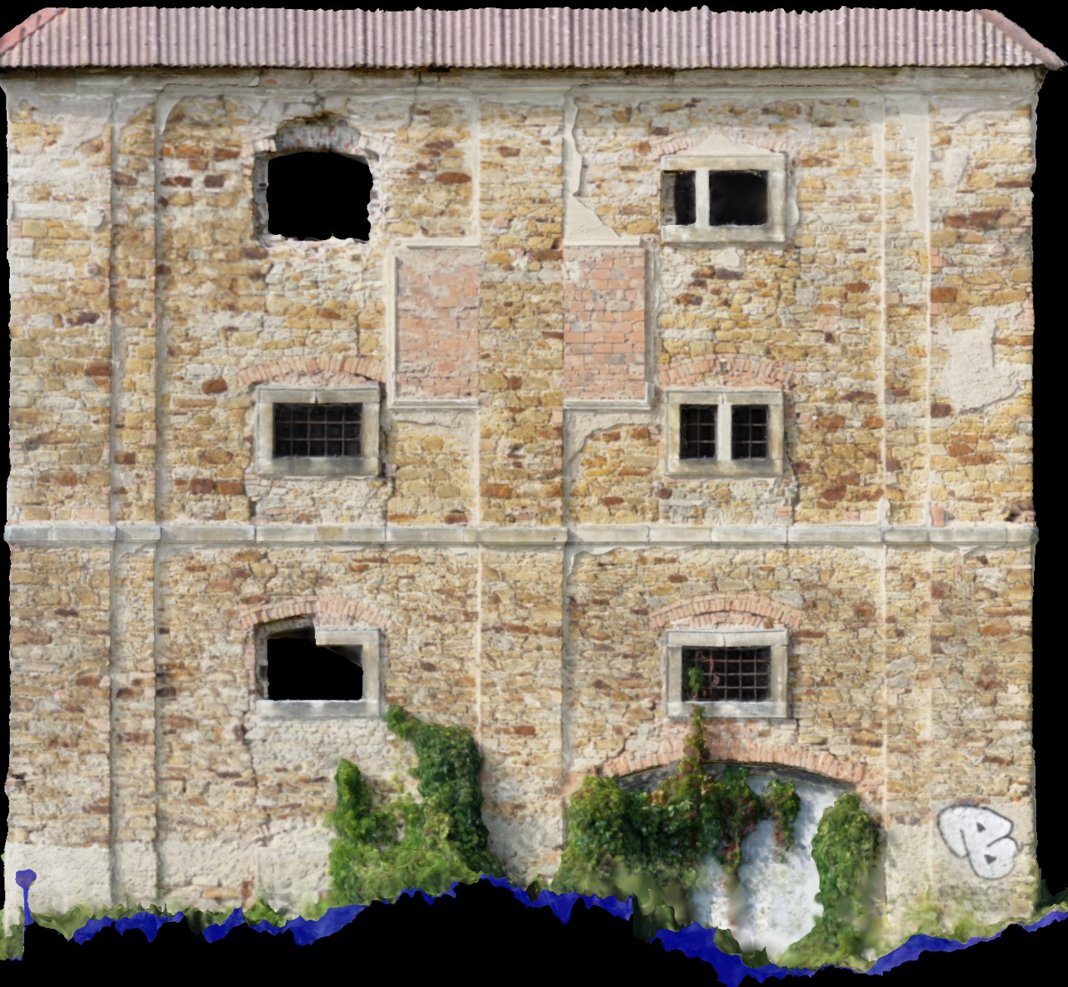
The most common customer requests fall within the field of aerial mapping and 3D modeling. Here we use high endurance flight platforms and state-of-the-art optical devices to maximize scanning efficiency and the quality of delivered results for our customers. The scanning plan is processed for the object or area of interest. The resulting image material is further processed into maps or 3D models with authentic texture. All outputs can be georeferenced (aligned in the global coordinate system) or subjected to further processing and data mining.
Mapping applications:
- Urban planning
- Civil engineering
- Forestry and game counting
- Precise agriculture
- Industrial Areas
Mapping outputs:
- Aerial images and maps
- Ortho-photo projection
- Georeferenced maps for geodesy and cartography
- Multi-channel maps combination of RGB and thermography
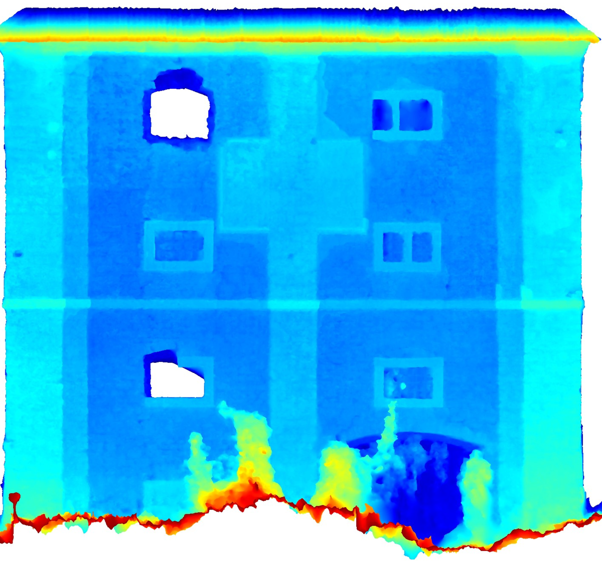
3D model application:
- Architecture and construction design
- Cultural heritage preservation
- Real estate presentation
- 3D visualization and virtual reality
- Measuring the volumes of quarries and landfills
3D model outputs:
- 3D models for projection and VR
- Models for volume estimation
- Detailed depth projection
- Vectorization of facades and building elements
- Data for visualization in architecture and developer projects
Remote Visual Inspection
The Remote Visual Inspection (RVI) methods are applied in the framework of aerial work for industrial subjects. In this field, we are able to provide our customers with, at least, separate flights for specific engagements that are realized in the team of our pilot and customer inspection professional. Such a team then performs remotely piloted scanning of the object with a camera where our company guarantees flight safety and all preparations, and the inspector provides navigation based on his expert knowledge to acquire the relevant data.
Even in this area, our company aims to automate processes and maximize efficiency of data acquisition, and we also offer advanced methods for our customers to obtain a 3D model or, using robust repeatability of the inspection flight, a time-lapse data set that documents the development of the inspected object.
Inspection applications:
- Industrial facilities inspection
- Bridge structural check
- Line structures supervision
- Civil engineering state evidence
- Pipes and smokestacks state check
- Corrosion mapping
Inspection outputs:
- Photographic or video evidence
- 3D models
- Thermographic composition
- Multispectral composition
- Time-laps data set
- Change detection and evidence
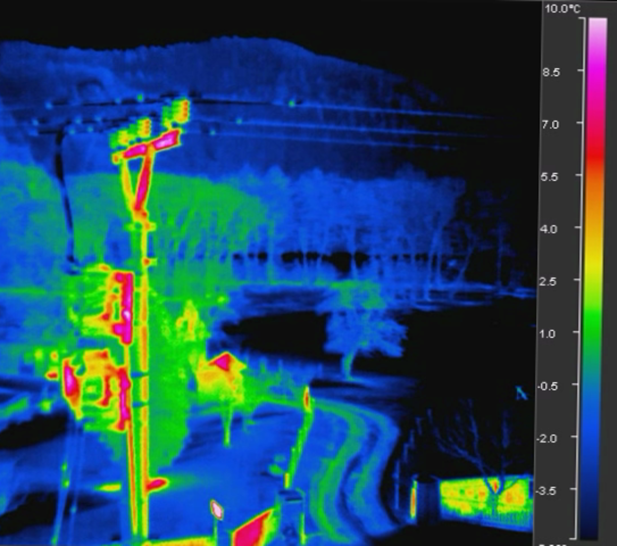
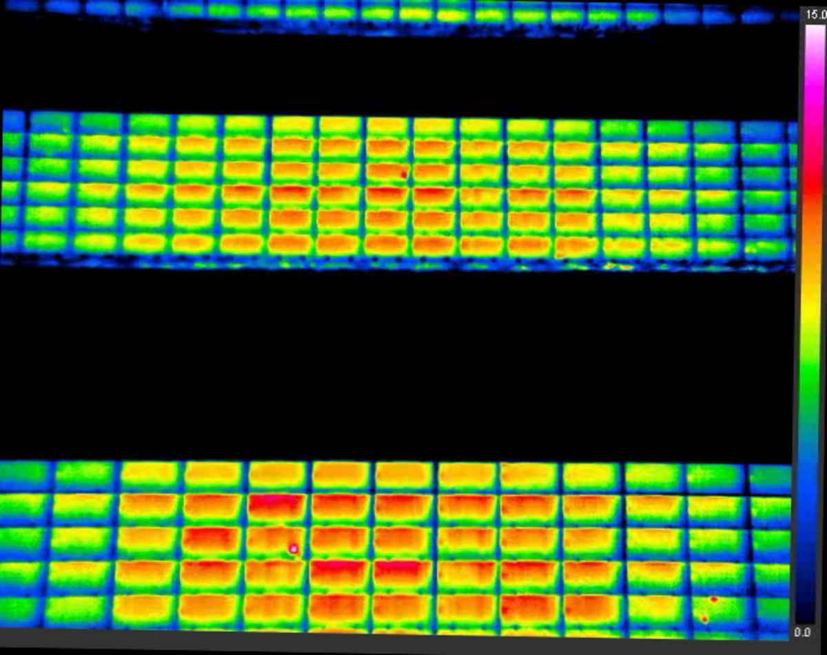
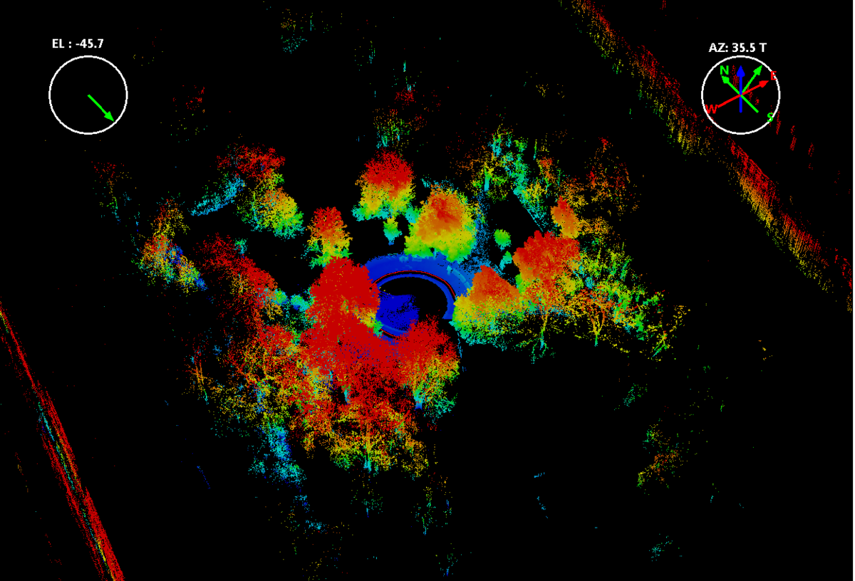
Thermography and Laser scanning
In addition to remote sensing using standard sensors, we are also able to offer our customers specialized sensor sensing. Among the most common are thermography and laser scanning using LIDAR. Such results can be combined to achieve very specific results that fit perfectly into the customer requirements. The most common application areas for thermography are thermal leakage of buildings and inspection of industrial sites and production processes. Laser scanning on the other hand can help in forestry and surface mining to evaluate and determine time changes with high precision.